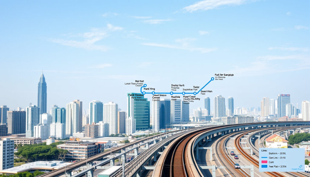
Blue Line MRT Map: Bangkok’s 43 Stations & Fares 2024
The MRT Blue Line is Bangkok’s connective tissue — 43 stations threading through markets, offices, and neighborhoods that buses simply cannot reach. For commuters mapping their route in 2024, this line is less a nice-to-know and more a survival skill. This guide walks through every station, the fare system, and how the Blue Line stacks up against the BTS Skytrain, all anchored to the latest available data.
Number of Stations: 43 · Line Length: 48.6 km · Opened: 2017 · Operator: BEM · Daily Ridership: 500,000+
Quick snapshot
- Official BEM PDF map available for download from Bangkok Expressway and Metro
- Interactive viewers show real-time station positions on transit apps
- Purple Line extension links at Tao Poon interchange point
- Contactless payment accepted (Rabbit card, bank cards)
- Tourist passes available at major stations
- Fares based on distance traveled with maximum THB 42
- Bang Sue: major hub for SRT and Airport Rail Link
- Tao Poon: interchange with Purple Line
- Phetchaburi: connects to Makkasan for Airport Rail Link
This technical overview confirms the operational parameters of Bangkok’s underground and elevated metro corridor.
| Attribute | Value |
|---|---|
| Line Name | Chaloem Ratchamongkon Line |
| Stations | 43 |
| Length | 48.6 km |
| Gauge | Standard gauge |
| Electrification | 750 V DC |
| Operator | Bangkok Expressway and Metro (BEM) |
What is the Blue Line MRT?
The Blue Line MRT is Bangkok’s third rapid transit corridor, running from Tha Phra in the west through the city’s central business district to Lak Song in the southeast. Operated by Bangkok Expressway and Metro (BEM), it opened in phases between 2004 and 2019, with the final western extension completing in December 2019 (Wikipedia). The line carries more than 500,000 passengers daily across its 43 stations, making it the busiest route in the MRT network.
Route Overview
The line stretches approximately 48.6 km, with the central section running underground through areas like Sukhumvit and Silom, and outer sections running elevated on concrete viaducts. This mix of tunnel and elevated track is unusual — most Asian metros commit to one or the other — but it reflects Bangkok’s constrained central corridor where tunneling was the only viable option.
Underground sections mean no mobile signal drops, no platform fresh air, and longer walks to street level. Budget extra time when connecting at stations like Sam Yan or Wat Mangkon.
Operator and History
BEM operates the Blue Line under a concession from the Bangkok Metropolitan Administration. The initial 14-station segment from Bang Sue to Hua Lamphong opened on July 3, 2004, serving as the MRT’s inaugural line (Wikipedia). Subsequent phases extended both ends: eastward to Tao Poon in 2017, then southward through the Old Town with stations like Wat Mangkon and Sam Yot opening in July 2019, and finally westward to Tha Phra in late 2019.
What are the MRT stations list?
The Blue Line’s 43 stations run from BL01 (Tha Phra) to BL38 (Lak Song) in the west, and BL10 (Tao Poon) eastward. Station codes follow the “BL” prefix followed by a sequential number. The line splits geographically, with the western leg serving areas like Bang Khae and the main corridor running through the city center.
Stations from North to South
The northern terminus section includes Bang Sue (BL11), Phahon Yothin (BL14), Lat Phrao (BL15), and Ratchadaphisek (BL18), serving dense residential neighborhoods that rely heavily on the MRT for commutes into the central business district. Park & ride facilities are available at Lat Phrao, Phra Ram 9, and Sam Yan stations (Wikipedia).
A sample of key stations demonstrates the phased rollout from 2004 through 2019.
| Station Code | Station Name | Opening Date | Platform Type |
|---|---|---|---|
| BL01 | Tha Phra | December 23, 2019 | Island |
| BL06 | Sirindhorn | December 4, 2019 | Side |
| BL10 | Tao Poon | August 11, 2017 | Side |
| BL11 | Bang Sue | July 3, 2004 | Side |
| BL20 | Phra Ram 9 | July 3, 2004 | Island |
| BL21 | Phetchaburi | July 3, 2004 | Island |
| BL28 | Hua Lamphong | July 3, 2004 | Island |
| BL29 | Wat Mangkon | July 29, 2019 | Stacked |
| BL37 | Bang Khae | September 21, 2019 | Side (Elevated) |
| BL38 | Lak Song | September 21, 2019 | Side (Elevated) |
The southern extension through the Old Town added stations like Wat Mangkon (BL29) and Sam Yot (BL30) with stacked platform configurations to accommodate narrow street widths, while the September 2019 openings at Bang Khae and Lak Song introduced elevated side-platform stations for the first time on this line.
Key Interchange Stations
Interchange points define how the Blue Line connects with Bangkok’s broader transit ecosystem. Bang Sue (BL11) serves as the northern anchor, linking to SRT commuter rail, the Airport Rail Link, and the planned high-speed rail to Chiang Mai. Tao Poon (BL10) connects eastward riders to the Purple Line. Phetchaburi (BL21) links to Makkasan, where travelers can board the Airport Rail Link to Suvarnabhumi Airport (Wikipedia).
Phetchaburi station sees heavy foot traffic from tourists catching the Airport Rail Link. The walking distance between the MRT platform and Airport Rail Link at Makkasan can exceed 400 meters — not ideal with luggage.
Is Blue Line MRT or BTS?
The Blue Line is an MRT line, operated by BEM, not the BTS Skytrain. This distinction matters because the two systems have different ticketing systems, different infrastructure standards, and different fare structures. MRT lines run underground through central Bangkok, while BTS lines (the Skytrain) run elevated on above-ground viaducts.
MRT vs BTS Differences
Bangkok’s MRT network consists of four lines: Blue, Purple, Yellow, and Pink, with Blue being the longest and most heavily used (Transit Bangkok). The Yellow and Pink lines are operated by BTS, not BEM — an arrangement that creates a two-operator ecosystem under the MRTA framework. In central Bangkok, MRT lines are tunneled underground; outside the central zone, both MRT and BTS lines can be elevated.
The infrastructure, operator, and operational history differ substantially between the two systems.
| Feature | MRT Blue Line | BTS Skytrain |
|---|---|---|
| Infrastructure | Underground (central) / Elevated (outer) | Elevated throughout |
| Operator | BEM | BTS Group |
| Initial Stations | 14 (opened 2004) | 23 (opened 1999) |
| Ticketing | MRT card / Contactless | BTS card / Contactless |
| Daily Ridership | 500,000+ | Varies by line |
The practical implication for riders: a journey across town using both systems requires separate top-ups and potentially a transfer at interchange stations like Silom or Sukhumvit, where BTS and MRT stations share proximity but are not integrated under one fare gate.
How much is the blue line in Bangkok?
MRT fares in Bangkok are distance-based, starting around THB 16 for short trips and scaling upward for longer journeys. The system accepts the MRT Rabbit card, bank contactless cards, and single-ride tokens purchased at station kiosks. Tourist passes offering unlimited rides over set periods are available at major stations for visitors who plan frequent use.
Fare Structure
Fares typically range from THB 16 to THB 42 depending on distance traveled. A trip from Bang Sue to Hua Lamphong (14 stations) would fall at the higher end of that range, while a single-station hop costs the minimum fare. Children, seniors, and disabled riders qualify for discounted fares upon presenting appropriate identification.
For tourists relying on the Blue Line to navigate between key districts (Sukhumvit, Silom, Chinatown), the Rabbit card saves both time and the hassle of carrying exact change for token machines.
Ticket Types
- MRT Rabbit Card: Reloadable stored-value card accepted across all MRT lines. Available at station counters with a THB 100 deposit plus loaded value.
- Single-ride Token: Paper token purchased for individual journeys. Requires exact fare or change at kiosk.
- Contactless Bank Card: Visa, Mastercard, and certain debit cards with contactless capability are accepted directly at gantries — no need for a separate card.
- Tourist Pass: Unlimited rides for 1, 3, or 5 consecutive days. Ideal for visitors covering multiple attractions in a short timeframe.
Which is better in Bangkok, MRT or BTS?
Neither system is universally better — the answer depends on where you’re going. The MRT Blue Line dominates north-south travel through Bangkok’s central corridor, while the BTS Skytrain excels in serving the Sukhumvit and Silom commercial districts that lie along its elevated routes. Choosing the right line means matching your destination to the network geometry.
Coverage Comparison
The BTS Skytrain covers Sukhumvit Road (the longest urban avenue in Thailand) and the riverside Silom district with stations at Nana, Asok, Phrom Phong, and Sala Daeng. The MRT Blue Line reaches areas the Skytrain cannot, including Bang Sue (connecting to railway and airport services), the Old Town temples near Wat Mangkon, and the Thonburi west bank via Tha Phra.
Crowd and Speed
MRT Blue Line trains run at shorter headways during peak hours than some BTS lines, but the underground stations mean longer vertical walks (escalators and elevators are available at most but not all stations). BTS elevated stations offer faster boarding access from street level, though during rush hour the Skytrain’s platforms at Asok and Siam can become severely congested.
Upsides
- Covers northern and western corridors that BTS misses entirely
- Connects to Airport Rail Link at Phetchaburi/Makkasan
- Underground routing provides climate-controlled comfort year-round
- Bang Sue hub links to SRT, Airport Rail Link, and future high-speed rail
Downsides
- Long underground walks to street level add travel time
- Separate ticketing from BTS requires two card systems
- Some stations (Wat Mangkon, Sam Yot) have stacked platforms — slower for wheelchair users
- West bank extension (Tha Phra area) serves lower-density residential zones
The implication: for travelers staying in the Sukhumvit-Silom axis, the BTS gets you closer to hotels and shopping. For anyone heading to Chatuchak market, the railway station, or the Old Town, the Blue Line MRT is non-negotiable.
Related reading: One Motoring Road Tax Renewal Guide · Raffles Medical Loyang Point Location Guide
urbanrail.net, setc-jsae.com, mrta.co.th, commons.wikimedia.org, guangdongmtr.home.blog, people.reed.edu
Frequently asked questions
Does Singapore have a Blue Line MRT?
Singapore’s Mass Rapid Transit system does not have a Blue Line. Singapore’s MRT network includes the North South, East West, Thomson-East Coast, Circle, and Downtown lines, color-coded in red, green, teal, orange, and blue respectively. The Blue Line MRT keyword in search queries almost always refers to Bangkok’s Chaloem Ratchamongkon Line.
How to download Blue Line MRT map PDF?
The official BEM MRT map is available through the Bangkok Expressway and Metro public website. Search for “BEM MRT route map” or visit the MRTA public information portal. Third-party transit apps like Citymapper and Google Maps also carry updated Blue Line schematics that sync with real-time arrival data.
What are the MRT-7 stations in order?
MRT-7 refers to the Yellow Line, which is a BTS-operated elevated rapid transit line connecting Lat Phrao in the north to Samut Prakan in the east. It is not the Blue Line. The Yellow Line opened in phases beginning in 2023 and includes stations like Kalantan, Phawana, and Saphan Khwai that connect to the MRT Blue Line at Phahon Yothin.
How many MRT stops are there?
The Blue Line MRT has 43 stations. Bangkok’s entire MRT network comprises four lines with a combined total of approximately 70 stations across the Blue, Purple, Yellow, and Pink lines.
How to pay for MRT Blue Line as tourist?
Tourists can use contactless bank cards (Visa, Mastercard) directly at MRT gantry readers without purchasing a separate card. Alternatively, buy a Rabbit card at any MRT station counter (THB 100 deposit plus top-up), or purchase single-ride tokens at station kiosks. Tourist passes for unlimited travel over 1, 3, or 5 days are available at major interchange stations.
Where does Blue Line MRT connect to BTS?
The Blue Line MRT does not share a direct physical interchange with the BTS Skytrain at the same station. However, several MRT stations are within walking distance of BTS stations: Khlong Toei (BL24) is near BTS Ploenchit and Nana, Sam Yan (BL27) is near BTS Sam Yan, and Hua Lamphong (BL28) is near BTS Saphan Taksin. Riders should allow 5–10 minutes for the walking connection between systems.
Is there a new Blue Line MRT map?
With the completion of the Tha Phra western extension in December 2019, the Blue Line MRT reached its current 43-station configuration. The line is not expected to expand further in the near term. M-MAP 2, the official master plan by the Department of Rail Transport, includes a proposed Blue Line Ring extension from Bang Khae to Phutthamonthon Sai 4 (an 8 km segment), but this requires environmental impact assessment clearance and has no confirmed construction timeline.
What the evidence shows
The Blue Line’s expansion between 2017 and 2019 represents one of Bangkok’s most significant transit infrastructure programs in recent decades. Verified data confirms the line’s role as the third rapid transit corridor after the BTS Sukhumvit and Silom lines.
Confirmed facts
- The MRT Blue Line is Bangkok’s third rapid transit line, following the BTS Skytrain lines
- 43 stations are currently active across 48.6 km
- The initial segment from Bang Sue to Hua Lamphong opened on July 3, 2004 with 14 stations
- BEM (Bangkok Expressway and Metro) operates the line under MRTA concession
- M-MAP 2 proposes a Blue Line Ring extension requiring EIA clearance before construction
What’s unclear
- The precise timeline for the Blue Line Ring extension remains unspecified in current public documents
- Ridership figures cited in some sources may reflect estimates rather than audited counts
- The extent to which the Blue Line will integrate with future high-speed rail connections at Bang Sue is still under planning review
The Bangkok MRT, also known as the Mass Rapid Transit, has four train lines, Blue, Purple, Yellow and Pink line.
M-MAP 2 is the official master plan by the Department of Rail Transport for rail transit in the Bangkok Metropolitan Region.
For commuters and tourists alike, the Blue Line MRT is not just a transit option — it is the connective tissue that links Bangkok’s fragmented urban landscape. Understanding which stations serve which purposes, and planning transfers before you’re underground without signal, is the difference between a smooth ride and a stressful detour.
More related posts
 Mumbai Indians vs Gujarat Titans Match Scorecard 2026
 Cast of Crazy Rich Asians: Characters, Sequel & FAQs
 When Is Mother’s Day 2026 in Singapore
 Pakistan vs Australia 1st T20I Scorecard 2026: Result
 Chinese New Year Singapore 2026: Events, Tips & What to Do
 Junction 8 Food Court Guide: Menu, Opening Hours & Halal
 Halloween Horror Nights 2025 Singapore: Dates & Guide
 1 for 1 Halal Buffet 2026: Best Deals in Singapore & Dublin
