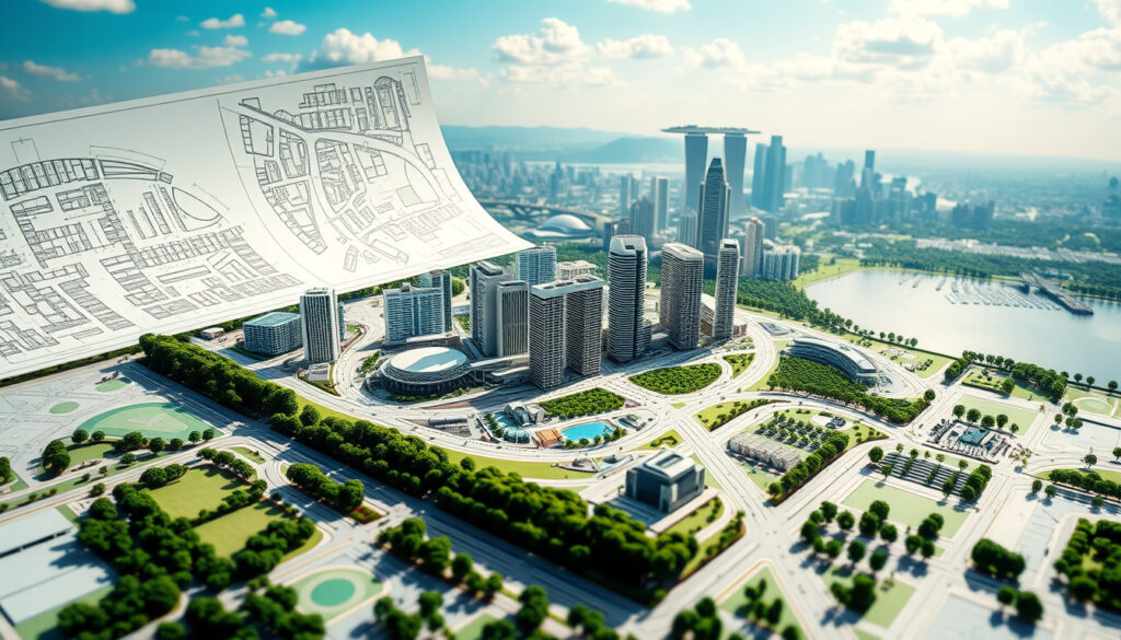
Singapore Master Plan 2025: Guide to URA Land Use & Planning
Anyone who’s tried to track Singapore’s physical transformation knows the map changes fast. The Singapore Master Plan 2025, gazetted on December 1, 2025, is the statutory blueprint that decides where new homes rise, which districts get denser, and how much green space stays untouched for the next 10 to 15 years.
Gazetted date: December 1, 2025 ·
Planning horizon: 10 to 15 years ·
Planning regions: 5 ·
New homes announced (Dover-Medway): ~6,000 ·
Land use categories: Residential, commercial, industrial, green, transport
| Fact | Value |
|---|---|
| Gazetted date | December 1, 2025 |
| Planning horizon | 10–15 years |
| Planning regions | 5 |
| New homes (Dover-Medway) | ~6,000 |
| Land use categories | Residential, commercial, industrial, green, transport |
Quick snapshot
- Statutory land use plan (Urban Redevelopment Authority)
- 10-15 year horizon (99.co)
- Gazetted Dec 1, 2025 (Urban Redevelopment Authority)
- Long-term strategic plan (URA)
- 40-50 year vision (URA)
- Updated every decade (URA)
- Sustainability roadmap (Singapore Green Plan)
- Focus on green energy, transport, and waste (Singapore Green Plan)
- Separate from land use plan (Singapore Green Plan)
- 5 regions: Central, North, North-East, East, West (URA)
- Each with distinct land-use strategy (URA)
- Mapped on URA site (URA)
For homebuyers and investors in Singapore, the Master Plan 2025 gazette date is the moment provisional land-use proposals become legally binding. If you’re eyeing a property near a rezoned corridor, the difference between “draft” and “gazetted” is the difference between possibility and permission.
What is the Singapore Masterplan 2025?
The Master Plan 2025 is Singapore’s statutory land-use plan — a legally binding document that controls how every parcel of land can be used for the next 10 to 15 years. The URA gazetted it on December 1, 2025, after a public engagement process that drew nearly 250,000 visitors to the exhibition and almost 500,000 online views.
Key objectives of the Master Plan
- Shaping a Happy and Healthy City — integrated green spaces, walkable neighbourhoods, and community facilities (URA)
- Enabling Sustainable Growth — new housing corridors such as Dover-Medway (~6,000 homes) and Mediapolis (~5,000 homes) (URA)
- Strengthening Urban Resilience — climate-adaptive infrastructure and flood protection measures
- Stewarding Nature and Heritage — protecting nature reserves and conserved buildings
How it differs from the Concept Plan
The Concept Plan is Singapore’s 40-to-50-year strategic vision, updated roughly once a decade. The Master Plan is its statutory short-to-medium-term implementation tool — the one with legal teeth.
The pattern: The Concept Plan dreams at 50,000 feet; the Master Plan builds at street level.
Because the Concept Plan is updated only every 10 years, the Master Plan sometimes carries weight the Concept Plan never had: a rezoning in MP2025 can immediately affect property values, while the Concept Plan’s “regional hub” designation remains advisory until the next Master Plan cycle.
“The Master Plan 2025 is a comprehensive blueprint that balances development needs with community aspirations.”
— URA Chief Executive
The implication: the Master Plan has immediate legal force that can reshape neighbourhoods, making it the single most important document for anyone tracking Singapore’s physical transformation.
What are the 5 planning regions of Singapore?
The Urban Redevelopment Authority divides Singapore into five planning regions, each with distinct development strategies and density guidelines.
| Region | Key districts | Master Plan 2025 focus |
|---|---|---|
| Central Region | District 9 (Orchard), 10 (Bukit Timah), 11 (Newton) | Intensification of commercial and residential hubs; new green corridors |
| North Region | Woodlands, Sembawang, Yishun | Regional centre expansion; industrial-to-residential conversion |
| North-East Region | Punggol, Sengkang, Hougang | Waterfront housing and recreational nodes |
| East Region | Bedok, Tampines, Changi | Mature estate rejuvenation; new commercial nodes |
| West Region | Jurong, Clementi, Bukit Batok | Jurong Lake District development; innovation district expansion |
The pattern across all five regions: the Master Plan 2025 pushes housing density toward transport nodes while protecting green spaces from development encroachment.
Central Region
- Home to Singapore’s richest districts (9, 10, 11) (URA)
- Rezoning of selected sites along Bukit Timah corridor for higher-density residential
- New park connectors linking Botanic Gardens to Singapore River
North Region
- Woodlands Regional Centre positioned as a key commercial hub outside the city (URA)
- Industrial land at Senoko being rezoned for mixed-use development
- New 2.5km coastal promenade at Sembawang
North-East Region
- Punggol Digital District expansion with 28,000 tech jobs targeted (URA Draft Master Plan)
- Sengkang Grand Mall integrated transport hub completion
- New waterfront housing at Punggol Point
East Region
- Tampines Regional Centre intensification with additional commercial floor space (URA)
- Bedok town centre rejuvenation with new community spaces
- Changi Airport-related business park expansion
West Region
- Jurong Lake District positioned as Singapore’s second largest commercial hub (URA)
- Mediapolis creative cluster adding ~5,000 homes
- Dover-Medway corridor with ~6,000 new homes announced
The Dover-Medway corridor and Mediapolis are the two most consequential new housing zones in MP2025. For prospective homebuyers in Singapore, these areas represent the intersection of new supply and future infrastructure — but the exact phasing of each development remains subject to subsequent detailed plans.
“The Draft Master Plan 2025 exhibition represented the culmination of two years of public engagement.”
— Ministry of National Development
The pattern: each region’s strategy reflects a trade-off between growth and conservation that the Master Plan must balance with legal precision.
What is included in the Master Plan?
The Master Plan is not a single document but a layered system: a Written Statement, zoning maps, and development control guidelines that together tell any landowner, developer, or homeowner what they can build and where.
Land use zones
| Zone type | Examples | Development control |
|---|---|---|
| Residential | Landed, non-landed (condo/HDB) | Plot ratio and height limits per zone |
| Commercial | Office, retail, hotel | Gross floor area and use mix requirements |
| Industrial | Business park, warehousing, factory | Noxious/non-noxious classification |
| Green spaces | Parks, nature reserves, conservation areas | No development allowed in most categories |
| Transport | Roads, rail corridors, ports | Reserve lines for future infrastructure |
Density and building height controls
- Plot ratio ranges from 1.4 (low-density landed) to 4.2 (high-density apartments) (URA)
- Building height is capped by “storey height” and “building height planes” (99.co)
- Conservation areas have stricter height limits and façade protections
Public engagement and the Draft Master Plan 2025 Exhibition
The Draft Master Plan 2025 exhibition ran from June 25 to November 29, 2025, at The URA Centre (45 Maxwell Road) and 14 other locations across Singapore. The URA Draft Master Plan reported that the exhibition drew almost 250,000 physical visitors and nearly 500,000 online views, making it one of Singapore’s most-engaged public planning exercises. Volunteer-guided public tours ran from June 26 to September 30, 2025.
The Ministry of National Development officially launched the exhibition on June 25, 2025, framing it as the culmination of two years of public engagement.
What this means: the Master Plan’s content is not just a technical document — it is shaped by public feedback and represents a negotiated vision for the city’s future.
What is the richest district in Singapore?
District 9 (Orchard, Cairnhill) and District 10 (Bukit Timah, Holland Village) are consistently ranked among Singapore’s most expensive residential areas. The Master Plan 2025 affects these districts through conservation protections and development caps that limit new supply.
District 9, 10, and 11
- District 9: Core city-fringe area with high-end condos and shophouses (URA)
- District 10: Bukit Timah corridor — landed estates and luxury apartments with green buffers
- District 11: Newton and Novena — medical hub with high-density residential
Impact of Master Plan on property values
Master Plan designations directly influence property demand and pricing. A rezoning from “residential” to “commercial” can raise a site’s value; a conservation restriction can limit redevelopment potential. For buyers in Singapore, checking the Master Plan 2025 zoning on the URA maps service is a due diligence step before any purchase.
The pattern: Master Plan zones are the primary driver of property value differentials, making them essential reading for any investor.
What is the Singapore Concept Plan 2030?
The Urban Redevelopment Authority describes the Concept Plan as the “long-term strategic plan” that guides Singapore’s physical development over 40 to 50 years. It is updated roughly every decade and sets broad directions — where major growth areas should be, which regions should be densified, what transportation corridors are needed.
Long-term vision vs statutory Master Plan
The crucial difference: the Concept Plan is advisory; the Master Plan is statutory. The Concept Plan identifies Jurong as a future regional hub in 2030; the Master Plan 2025 makes it legally possible by rezoning specific plots today.
Relationship with the Singapore Green Plan 2030
The Singapore Green Plan is a separate, cross-agency roadmap covering energy, waste, transport, and green finance. It influences the Master Plan through requirements for green building standards, electric vehicle charging infrastructure, and park connector networks, but it is not a land-use document itself.
For Singapore residents, the gap between the Concept Plan’s long-term vision and the Master Plan’s short-term zoning can create friction: a neighbourhood slated for “green expansion” in the Concept Plan may still be rezoned for housing in MP2025 if near a new MRT station. The two plans don’t always move in lockstep.
The implication: the Concept Plan provides the vision, but the Master Plan decides what happens on the ground — and that can sometimes surprise residents.
Timeline of the Master Plan 2025 process
- Early 2025: Draft Master Plan 2025 Exhibition opens (URA Draft Master Plan)
- Mid 2025: Public engagement sessions and feedback collection (URA)
- December 1, 2025: Master Plan 2025 gazetted (URA)
- 2026 onward: Implementation of land-use changes (URA)
The pattern: each phase of the Master Plan process builds on public input, making the final gazetted document a product of negotiation and legal finality.
Confirmed facts and what remains unclear
Confirmed facts
- Master Plan 2025 was gazetted on December 1, 2025 (Urban Redevelopment Authority)
- It is the statutory land use plan for 10-15 years (URA)
- The plan includes ~6,000 new homes in Dover-Medway area (URA)
- Nearly 250,000 visited the Draft Master Plan exhibition (URA)
- Five planning regions are used for land-use planning (URA)
What’s unclear
- Exact number of homes in Mediapolis (~5,000 stated but may change) (URA)
- Specific timeline for each region’s development under the plan
- Exact impact of zoning changes on individual property values
- Phasing of the Dover-Medway corridor development
- Exact number of homes in Mediapolis (~5,000 stated but may change) (URA)
The catch: while many facts are confirmed, the implementation schedule and precise numbers for new housing zones remain fluid until detailed plans are released.
necrg.moe.edu.sg, channelnewsasia.com, linkedin.com, youtube.com, ura.gov.sg, instagram.com, linkedin.com, youtube.com
För den som följer stadsutvecklingen i Singapore är det intressant att notera att Liu Thai Kers son Daniel Liu nu kliver in i politiken med en bakgrund inom just planering.
Frequently asked questions
What is the purpose of the Master Plan?
The Master Plan is the statutory land-use blueprint that controls land use, density, and building height across Singapore for 10 to 15 years. It is legally binding and guides all development applications.
How does the Master Plan affect property buyers?
Master Plan zoning determines what can be built on any site, which directly influences property values. Buyers should check the URA Master Plan map to see if a property’s surrounding area is zoned for conservation, intensification, or new infrastructure.
What is the Draft Master Plan 2025 Exhibition?
It was a public exhibition held from June 25 to November 29, 2025, at The URA Centre and 14 other locations, where the public could view proposed land-use changes and provide feedback before the plan was gazetted.
How can I view the Master Plan 2025 map?
The URA Master Plan map is available online through the URA’s maps service at URA.gov.sg.
Does the Master Plan regulate building height?
Yes. The Master Plan specifies maximum building height (in storeys and absolute height) and plot ratio for every land parcel in Singapore.
How does the Master Plan relate to the Concept Plan?
The Concept Plan is the long-term strategic vision (40-50 years). The Master Plan is the statutory implementation tool (10-15 years) that legally rezoned land to achieve the Concept Plan’s goals.
Related reading
- Singapore GDP Per Capita: Rankings, History & Why So High — economic context for the Master Plan’s land-use decisions
- Kallang Alive Sport Management: CEO, Ownership & Contact Info — a case study of a major Master Plan-driven development precinct
More related posts
 What Is Withholding Tax in Ireland? PSWT and DIRT Explained
 Standard Chartered Journey Credit Card – Benefits, Miles & Fees
 High White Blood Cell Count: Causes, Treatments & When to Worry
 Stella Sora Tier List 2026: Best Characters Ranked
 Eco Shop Share Price: IPO, Targets & Current Price
 Alcove at Caldwell House: Wedding Packages & Pricing
 Chinese New Year Singapore 2026: Events, Tips & What to Do
 Cast of Crazy Rich Asians: Characters, Sequel & FAQs
