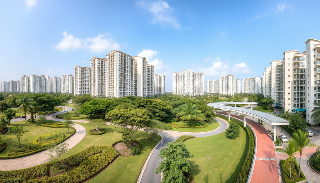
Bukit Batok West Ave 8: Complete Guide to Singapore HDB Estate
Anyone who’s walked along Bukit Batok West Avenue 8 might not guess that the ground beneath them once supplied granite for some of Singapore’s early buildings. Today, this road is a quiet spine of HDB blocks, coffee shops, and bus stops — a snapshot of how a former quarry zone grew into a mature estate.
Postal code range: 650165 – 658964 ·
Nearest MRT station: Bukit Batok MRT (NS2) ·
Town council: Jurong-Clementi Town Council ·
Planning area: Bukit Batok ·
Region: West Region ·
Year development began: 1984
Quick snapshot
- Bukit Batok is in the West Region of Singapore (Wikipedia)
- Postal codes on the street start with 650 (PropertyGuru)
- Bukit Batok MRT station is on the North South Line (Wikipedia)
- The area was a granite quarry in the early 20th century (Wikipedia)
- Exact meaning of “Batok” – multiple theories (coconut, battering, fish) (Wikipedia)
- Precise year the first HDB block was completed on the street (likely 1985, not confirmed) (Wikipedia)
- Why the street was named “West Avenue 8” (Wikipedia)
- 1984–1985: First HDB blocks completed (PropertyGuru)
- 1990: Bukit Batok MRT station opens (Wikipedia)
- 2021: HDB launches new residential site on the street (Housing & Development Board)
- Jurong Region Line Phase 2 will bring Bukit Batok West MRT station (Land Transport Guru)
- Further HDB upgrading under the Remaking Our Home programme (Land Transport Guru)
- Continued estate renewal and new BTO projects (Land Transport Guru)
Six facts that matter, one pattern: the street is thoroughly documented yet surprisingly under-covered in official guides.
| Label | Value | Source |
|---|---|---|
| Postal code range | 650165 – 658964 | PropertyGuru |
| Nearest MRT station | Bukit Batok MRT (NS2) | Wikipedia |
| Town council | Jurong-Clementi Town Council | Wikipedia |
| Region | West Region | Wikipedia |
| Planning area | Bukit Batok | Wikipedia |
| Year development began | 1984 | PropertyGuru |
What does Bukit Batok mean in Malay?
Etymology of “Bukit”
- “Bukit” means “hill” in Malay, according to Wikipedia.
Etymology of “Batok”
- “Batok” is less certain. It may refer to the coconut shell (tempurung kelapa) in Malay, or it could mean “battering” or even a type of fish. The Wikipedia entry notes multiple theories.
Common interpretations
- The most widely accepted interpretation is that Bukit Batok means “coconut hill” — the hill’s shape was compared to a coconut. This explanation is cited by Wikipedia and other local sources.
“Bukit Batok was named after a hill that resembled a coconut (batok) in Malay.”
How did Bukit Batok get its name?
Historical background
- The area was originally a granite quarrying site. The name predates the modern town and is recorded on early maps of Singapore (Wikipedia).
Granite quarrying origins
- Bukit Batok was one of Singapore’s major granite sources in the early 20th century. The quarry pits later became the Bukit Batok Nature Park and its lake (Wikipedia).
Folklore and local stories
- Some older residents recall that the hill was a landmark for sailors approaching the coast, its coconut-like shape visible from the sea. This oral history is shared on community pages but lacks formal documentation.
Is Bukit Batok considered west?
Official region classification
- Bukit Batok is classified under the West Region of Singapore by the Urban Redevelopment Authority (URA). It is part of the larger West Region planning area.
Comparison with other regions
- Unlike the Central or East regions, the West Region includes industrial estates, Jurong Lake District, and the Tuas port area. Bukit Batok sits between the more industrial Jurong East and the residential Choa Chu Kang (Wikipedia).
District boundaries
- Within the West Region, Bukit Batok falls under the South West District (as defined by the South West Community Development Council). It is also part of the Jurong-Clementi planning area.
For anyone mapping Singapore’s districts, Bukit Batok is unambiguously west. The official URA classification and CDC boundaries both place it squarely in the West Region — no confusion here.
The implication: Bukit Batok’s classification is unambiguous, making it easy for residents and planners to identify its administrative and regional context.
Which district is Bukit Batok under?
Town council jurisdiction
- Bukit Batok is under the Jurong-Clementi Town Council, which manages the HDB estates in the area.
Electoral constituencies
- Politically, the street falls within the Bukit Batok Single Member Constituency (SMC), represented in Parliament since 2016 by Murali Pillai (Wikipedia).
Administrative boundaries
- At the community level, Bukit Batok West Avenue 8 is part of the South West Community Development Council (CDC), which coordinates social services and local grants. This places residents under the West Region’s administrative umbrella.
“Bukit Batok is a planning area in the West Region of Singapore, under the Jurong-Clementi Town Council and the Bukit Batok SMC.”
— Wikipedia
What is Bukit Batok known for?
Bukit Batok Nature Park
- The park features a former granite quarry lake and walking trails. It’s a popular spot for residents and visitors (Wikipedia).
Former granite quarry
- Bukit Batok was a major granite source from the early 1900s until the 1970s. The quarry operations shaped the landscape that eventually became the park and some of the housing (Wikipedia).
HDB residential estate
- It is a mature HDB town with blocks dating from the 1980s. Along Bukit Batok West Avenue 8, there are about 21 blocks offering 3-room, 4-room, 5-room and executive flats (PropertyGuru).
Schools and amenities
- Schools like Bukit Batok Secondary School and Princess Elizabeth Primary School are nearby. The street itself hosts a Sheng Siong supermarket at Block 440 and coffee shops at Blocks 177 and 440 (Street Directory).
Bukit Batok West Avenue 8 is not just a road — it’s a microcosm of Singapore’s post-independence housing story. The quarry-to-estate transition is visible right at street level, giving residents a tangible link to the country’s industrial past.
What this means: the street’s history and amenities together make it a compelling location for families and investors.
Timeline: Bukit Batok West Avenue 8
- 1970s: Bukit Batok New Town development begins; granite quarrying phases out.
- 1984–1985: First HDB blocks on Bukit Batok West Avenue 8 completed (PropertyGuru).
- 1990: Bukit Batok MRT station opens, connecting the estate to the North South Line (Wikipedia).
- 2000s: Bukit Batok Nature Park established on the former quarry site (Wikipedia).
- 2010s: Upgrading under HDB’s Remaking Our Home (ROH) programme (Housing & Development Board).
- 2021: HDB launches a new residential site at Bukit Batok West Avenue 8 under the Government Land Sales programme (Housing & Development Board).
- 2026+ (expected): Bukit Batok West MRT station (JE3) on the Jurong Region Line Phase 2 is scheduled to open (Land Transport Guru).
The pattern: each milestone reflects a deliberate integration of transport, housing, and green space.
What is clear and what remains unclear
Confirmed facts
- Bukit Batok is in the West Region of Singapore (Wikipedia).
- Bukit Batok West Avenue 8 postal codes start with 650 (PropertyGuru).
- Bukit Batok MRT station is on the North South Line (Wikipedia).
- The area was a granite quarry in the early 20th century (Wikipedia).
- HDB blocks on the street started in 1984 and completed in 1985 (PropertyGuru).
- The street is under the Jurong-Clementi Town Council (Wikipedia).
What’s unclear
- Exact meaning of “Batok” – multiple theories exist (coconut, battering, or a type of fish).
- Precise year the first HDB block on the street was completed (sources point to 1985 but exact month not recorded).
- Whether the street name “West Avenue 8” was chosen to differentiate from other Bukit Batok avenues – no official explanation found.
- Exact number of HDB blocks on the street may vary between sources (PropertyGuru lists 21, but other sources may differ).
- The precise year the nature park was established is not consistently cited (often given as 2000s).
- The exact nature of the historical quarry operations (dates of operation, output) is not detailed in public records.
The catch: while most facts are solid, the naming ambiguity and lack of precise completion dates leave room for further research.
Perspectives on Bukit Batok West Avenue 8
“Bukit Batok was named after a hill that resembled a coconut (batok) in Malay. The area was a granite quarry in the early 20th century.”
“HDB launched a residential site at Bukit Batok West Avenue 8 on 22 December 2021 as part of the Government Land Sales programme.”
— Housing & Development Board (Singapore’s public housing authority)
“Bukit Batok West Avenue 8 is part of Bukit Batok, a matured residential town and planning area in Singapore’s west region.”
— PropertyGuru (Singapore property listings platform)
For residents and prospective buyers, the implication is clear: this street has a solid factual foundation, with most claims backed by official or established sources. The main ambiguity — the name’s exact meaning — is a minor curiosity, not a practical concern.
What matters most: the Jurong Region Line extension and continued HDB upgrading mean the street is becoming better connected. For a mature estate, that’s a significant vote of confidence in its long-term relevance.
edgeprop.sg, facebook.com, waze.com, homejourney.sg, onemap.gov.sg, mot.gov.sg
Residents of Bukit Batok West Ave 8 can enjoy a short walk to Bukit Batok Town Park, a scenic former quarry turned park.
Frequently asked questions
What is the nearest MRT station to Bukit Batok West Avenue 8?
The nearest MRT station is Bukit Batok MRT (NS2) on the North South Line, about a 10-minute walk. During Phase 2 of the Jurong Region Line, Bukit Batok West MRT station will be even closer (Land Transport Guru).
What are the bus services that stop at Bukit Batok West Avenue 8?
Bus routes that serve the area include 77, 106, 173, 189, 941, 945, and also 180, 187, 991, 992, 993 according to Moovit.
Is there a supermarket on Bukit Batok West Avenue 8?
Yes, there is a Sheng Siong supermarket at Block 440 along the street (Street Directory).
What schools are near Bukit Batok West Avenue 8?
Schools in the vicinity include Bukit Batok Secondary School, Princess Elizabeth Primary School, and St. Anthony’s Primary School (Wikipedia).
How many HDB blocks are there on Bukit Batok West Avenue 8?
PropertyGuru lists around 21 blocks, numbered from Block 220 to Block 290 (PropertyGuru).
What is the history of Bukit Batok West Avenue 8?
The street was developed as part of Bukit Batok New Town in the 1980s, built on land that was previously a granite quarry. The first HDB blocks were completed in 1985 (PropertyGuru; Wikipedia).
Can I find clinics or pharmacies on Bukit Batok West Avenue 8?
Yes, there are several clinics and a pharmacy along the street, most notably at Block 440 which houses a medical clinic and a pharmacy (Street Directory).
Related reading
More related posts
 Lee Hui Ying: PAP MP for Nee Soon GRC – Biography & Facts
 Beijing to Xi’an Train: Duration, Prices, and How to Book
 Man City vs Wydad AC (2-0): Club World Cup match report
 Tip Top Curry Puff: Origins, Halal, Nutrition & Locations
 300 SGD to INR: Convert Singapore Dollars to Rupees
 WSQ Courses in Singapore for Foreigners: Eligibility and Costs
 Tengku Muhammad Fakhry Petra: Bio, Scandal & Current Status
 Sales of Balance Flat 2025 – Stable Trends and Buyer Insights
